World Port (Middle Ages)
World Port (Middle Ages)
-
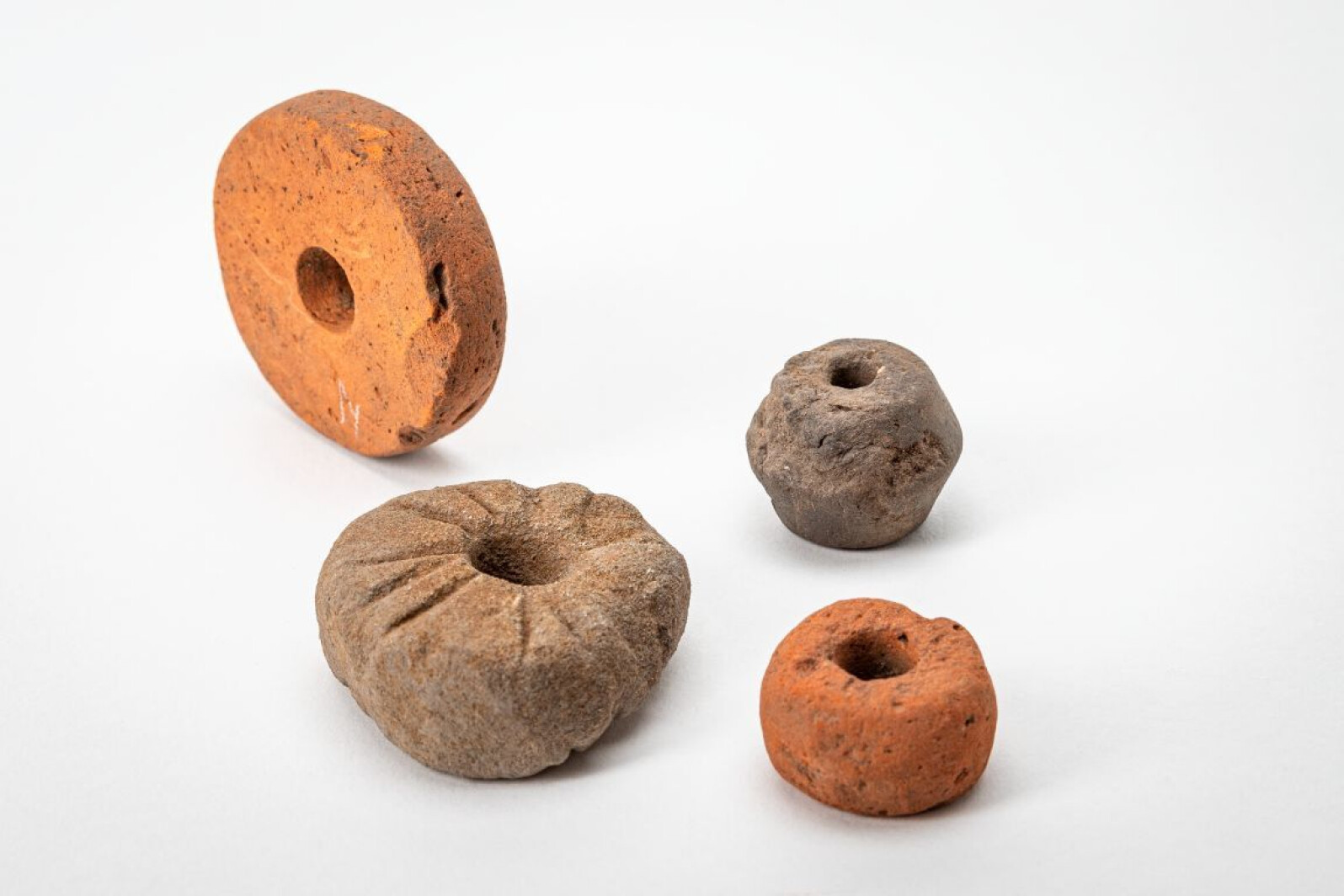
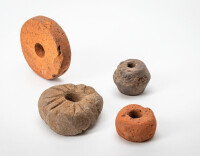
Whorls like these - made from natural stone or ceramics - were used to spin wool. A stick was pushed through the opening in the whorl. A tuft of wool would have been twisted into a thread, which was then attached to the stick. The combination of whorl and stick looks like a spinning top, as you can see in the drawing. You held the end of the thread between your fingers and let the top dangle down on the thread - the weight of the whorl made the top hang tight. By then spinning the top, you could spin the wool.
-
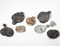
A cloth lead is a hallmark that was attached to a piece of cloth to show that it met the quality standards set by the guild. Flanders was primarily known for its broadcloth, a sheep's wool fabric that was sought after across Europe. In 2021, no fewer than 240 medieval cloth leads were found under Bruges' King Albert I Park, some of which you can see here. They would have been brought to Bruges by traders from production centres around the county of Flanders.
-
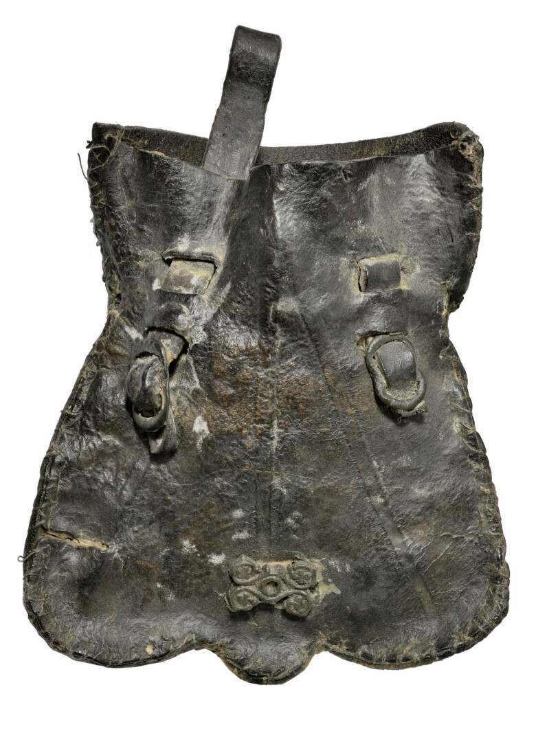
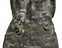
This leather purse was found in Bruges. The two handles, also made of leather, are intended for attaching the purse to a belt.
The money purse (in Dutch: ‘beurs’) was the symbol of the Van der Buerse family. From the mid-13th century, they operated an inn on a square in the city. Members of the family were also active as brokers and bankers. Over time, the square, named 'Ter Beurze' after the inn, developed into the financial heart of the city. Traders met there to conduct business and exchange information on the international economic and political situation. The Dutch word 'beurs', which had long referred to a (money) pouch, thus took on a new meaning that we still know today: stock exchange. The ‘beurs’ or Bruges stock exchange became a household name, and foreign merchants took the word back to their countries: first the Italians ('borsa'), but soon the French ('bourse'), the Germans ('Börse'), the Russians ('birzha'), the Czechs ('burza'), the Swedes ('börs') and the Danes and Norwegians ('børs').
-

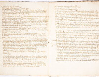
In 1371 and 1384, a number of English ships were seized at Sluis. That is what this report says. It offers us a unique insight into the role of Bruges as a hub for international trade.
In the Middle Ages, the Flemish economy was closely intertwined with the English one. Products from Italy and Spain found their way to the English market via Flanders, especially Bruges. In turn, Flanders could not do without English wool for its broadcloth industry. In addition to wool, English ships also landed grain, beer and herring.
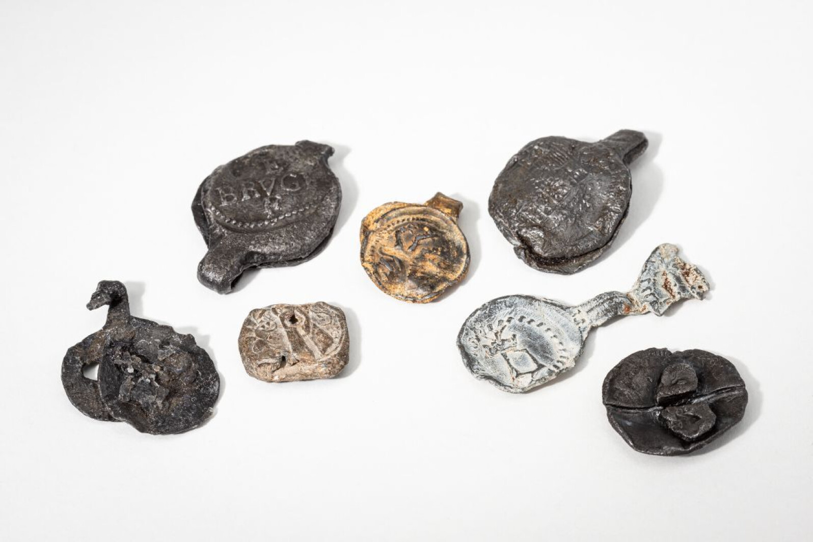
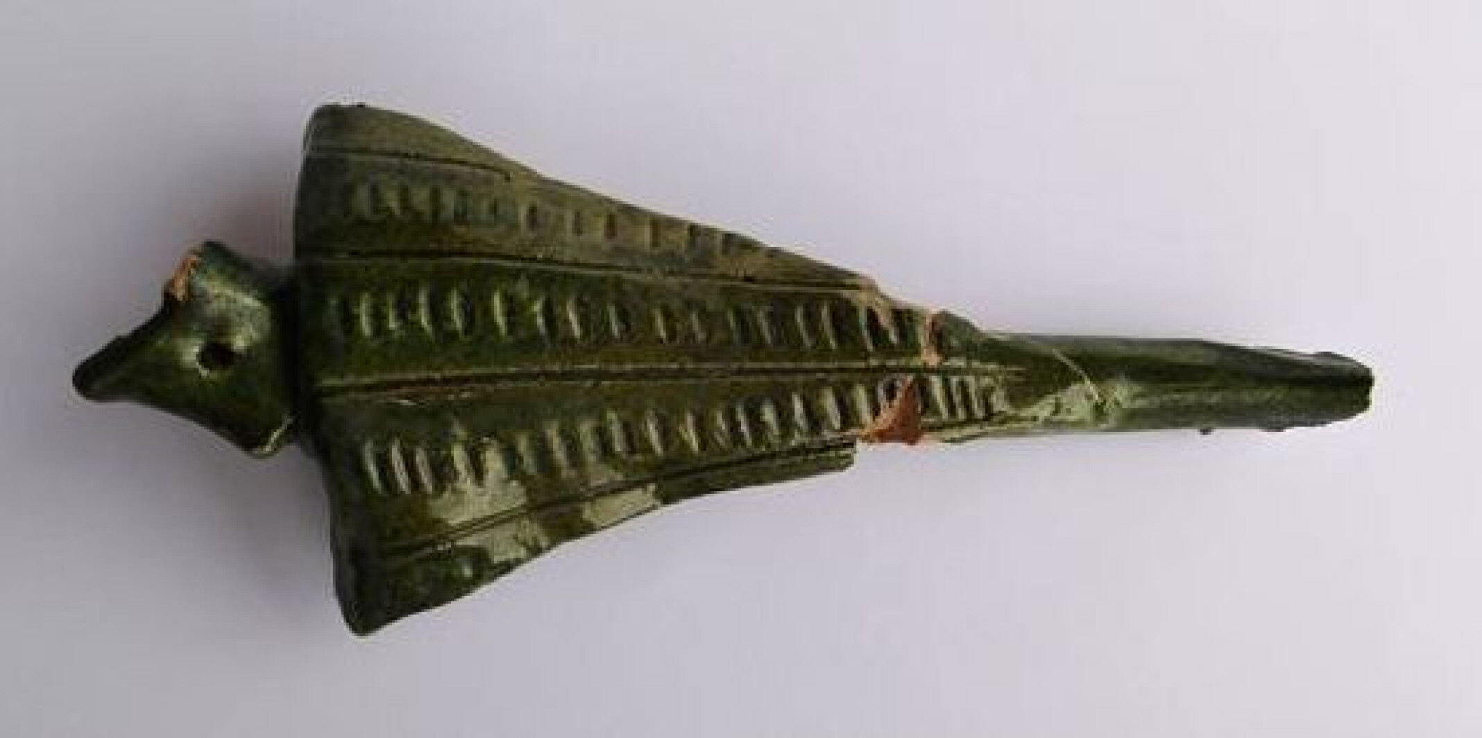
Most bales of wool were marked with seal stamps - marks of Italian merchants. These acted from Bruges as brokers in the wool trade between Calais, where the English stored their wool, and the Netherlands. The seal stamps would be applied to the packaging after the buyer had paid an advance or provided a purchase guarantee. The stamps shown here were found along the canals and the Zwin channel - waterways that connected Bruges to the ports of the Zwin.
-
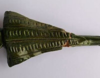
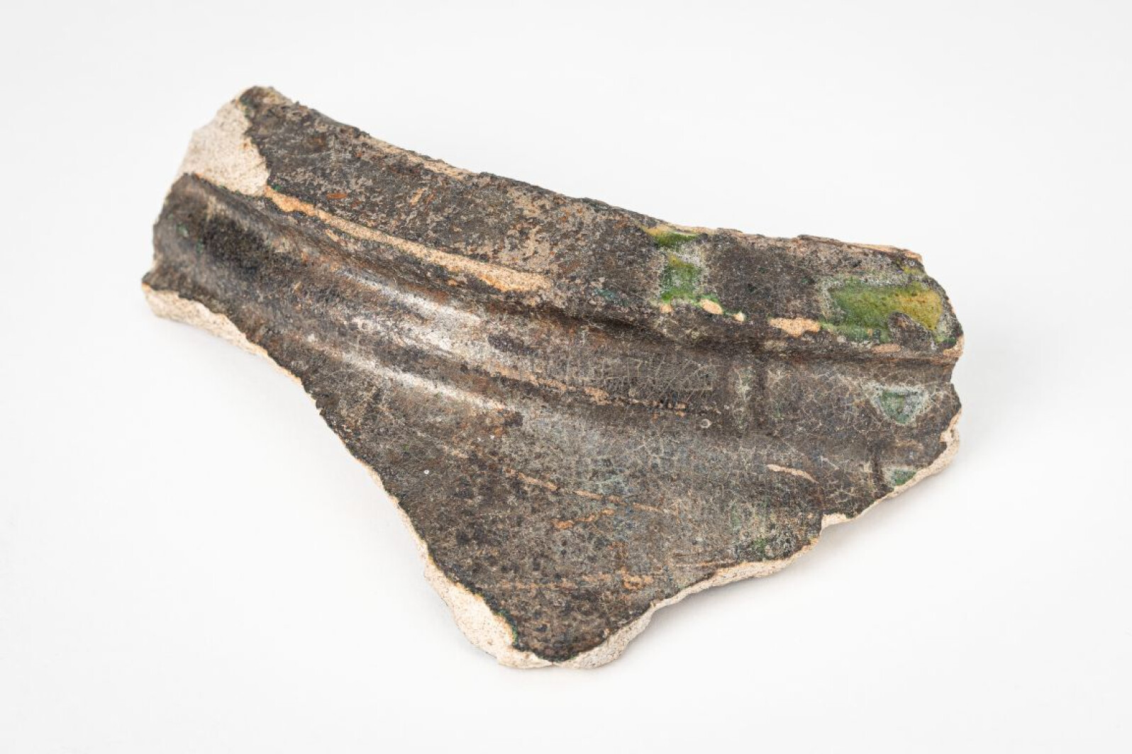
This sherd was found among the remains of the Hanseatic House in Hoeke, one of Bruges' outports on the Zwin. It is a fragment from a so-called Knight Jug, made in Scarborough in the English county of Yorkshire. These jugs were a type of green-glazed pottery, decorated with representations from the knight culture. They were popular in the 13th and 14th centuries and have been found at medieval sites all along the North Sea. The fragment from Hoeke depicts a knight with shield and was probably a decorative element on the neck of the jug.
-
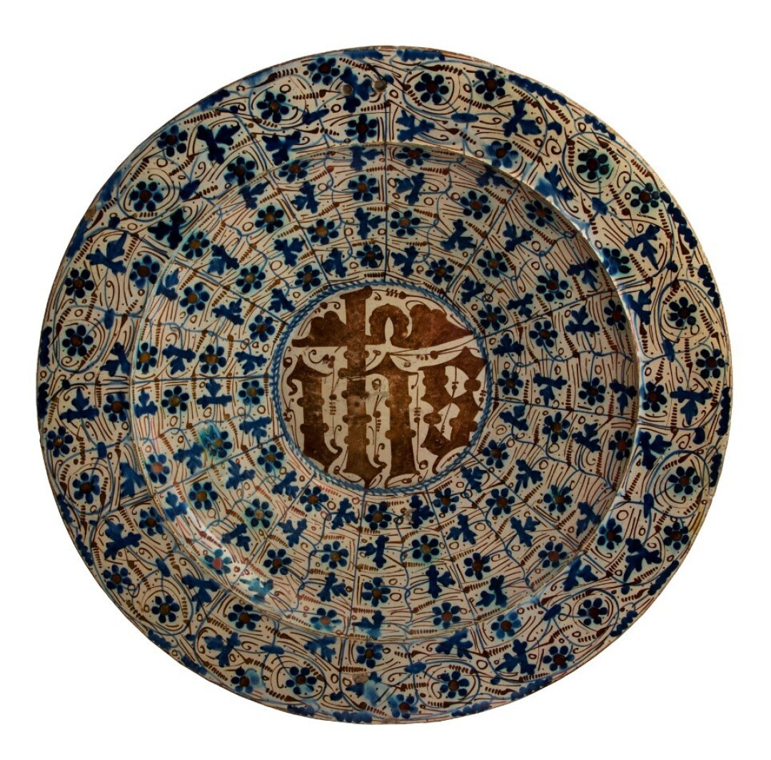
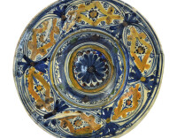
This dish is an example of lustreware: pottery that has a golden metallic sheen thanks to a special technique. Islamic potters from Valencia specialised in it. You can clearly recognise Eastern influences in this dish, such as the blue plant motifs. And if you read the IHS (Jesus) monogram upside down, it is... an Arabic greeting of salvation.
Spanish-Moorish pottery like this was imported in large quantities through the port of Sluis during the late Middle Ages. The port had obtained a permit from the city of Bruges to trade the pottery.
-
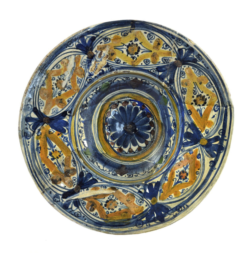
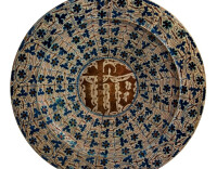
This small majolica plate was made in the Italian town of Montelupo, near Florence. In the 14th and 15th centuries there were intense economic and cultural ties between Bruges and the Italian city-states. Venice, Genoa and Florence had their own natiehuizen (‘national houses’) at the Beursplein in Bruges. The Florentines acted as brokers and bankers, and introduced new financial techniques such as bills of exchange and giro accounts. These would gradually displace cash transactions.
-
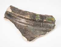
This is a sherd of a storage jar from the Near East, possibly from Syria. Pots such as these are also called martabani and were used for storing exotic produce. This rare find was made on the site of the Prinsenhof, the luxurious Bruges residence of the dukes of Burgundy.
-
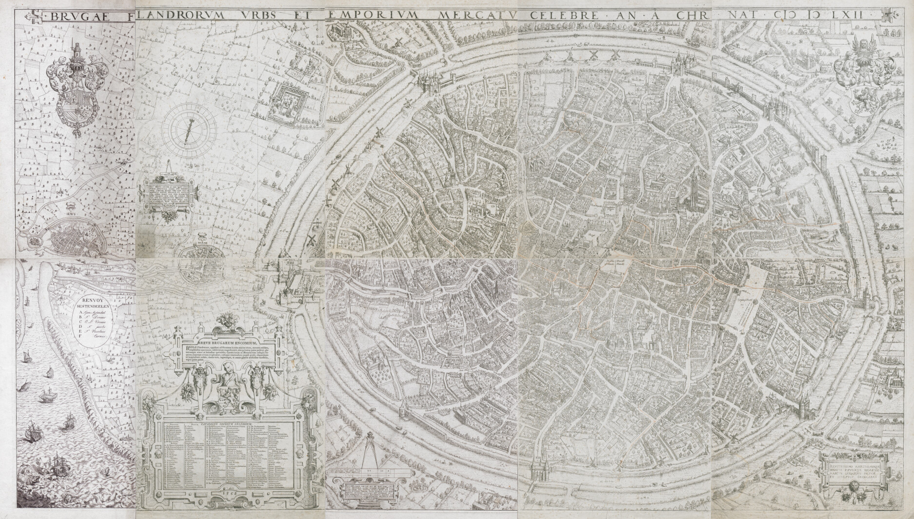
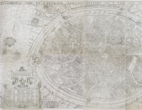
In 1561, the city council commissioned local artist Marcus Gerards to create a detailed map of Bruges. Its purpose was to show that the city was easily accessible by sea.
In the 16th century, the silting of the Zwin, Bruges' lifeline, was accelerating. This made it harder for merchant ships to sail from the North Sea to the city. To a trading metropolis such as Bruges, that was a real concern - and so the city council had a new canal to the sea dug: the Verse Vaart. On the map, it is the middle of the three waterways running from the city to the left.
Gerards' map was to advertise the canal, luring traders and other visitors by showing how easy it was to sail into the city. To add extra emphasis to that message, Gerards even misrepresented reality and depicted the distance between Bruges and the sea as much shorter than it really was. He also drew the channels much wider.
Marcus Gerards has created a masterpiece: a meticulous, three-dimensional representation of all the city's houses, gates, mills, waterways, streets and squares. The map is unique in its kind and gives a stunning picture of what Bruges looked like in the 16th century. In fact, you can use it to this day to find your way around the city.