-
In the late Middle Ages, Bruges is one of the richest cities in Western Europe. With its glorious Belfry, impressive City Hall and stately homes, it exudes pride and self-assuredness.
The source of all this prosperity is trade. Bruges is linked to the oceans via the Zwin, a short, shallow inlet of the North Sea. Ships from far and wide sail to and fro.
Bruges has been part of the Burgundian territories since the end of the 14th century. The Dukes of Burgundy regularly take up residence there. They flaunt their power and wealth through spectacular parades, festivities and tournaments.
Ambitious residents follow in their footsteps. They build sumptuous mansions, which they decorate ornately with their coat of arms and motto. Or they have themselves painted with the collar of the order of their knighthood. Louis de Gruuthuse is one of them.
-
This is Bruges at its finest! Bruges as it grows and flourishes long before and also after 1400. First as a centre of trade, gradually as a cosmopolitan European capital and finally as a splendid Burgundian city.
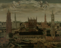
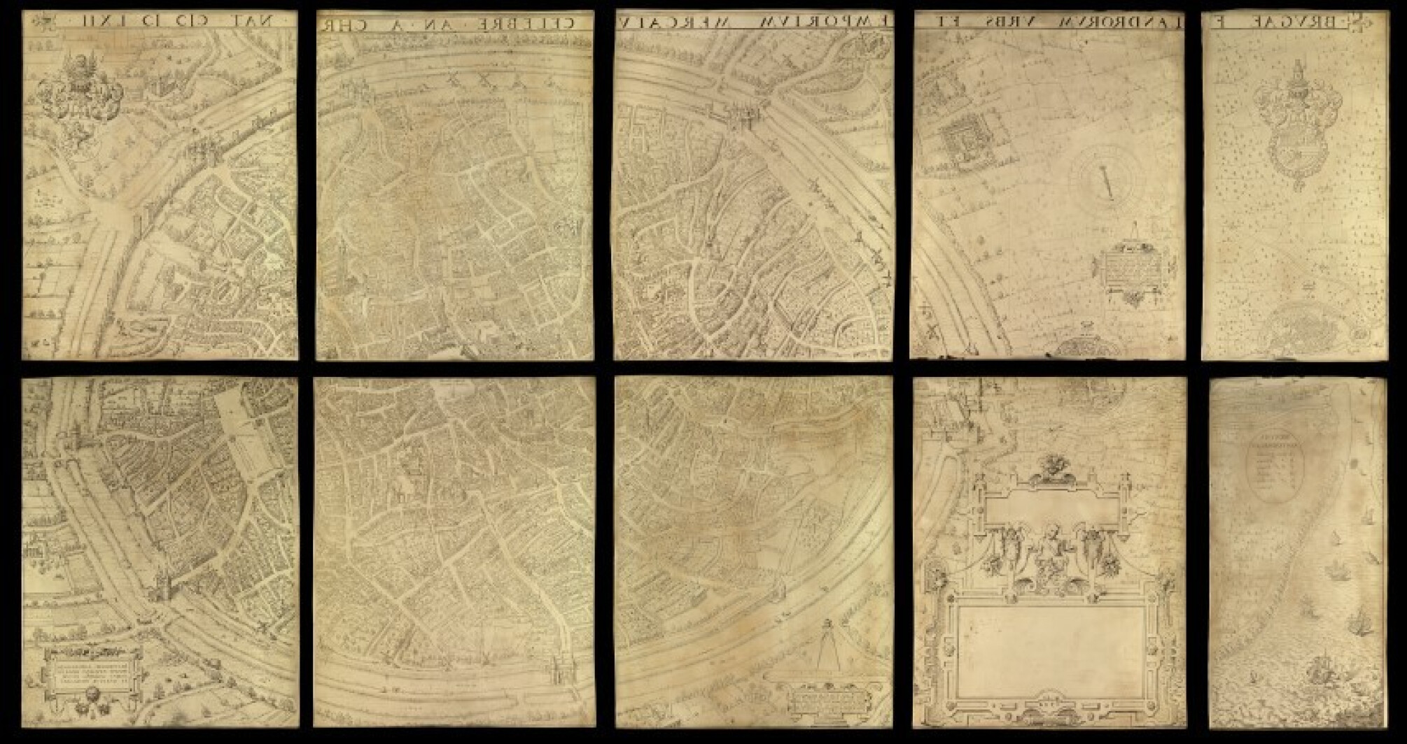
Marcus Gerards depicts Bruges in meticulous detail on these ten copper plates. As a mirror image, we should say, because the plates are for printing the map of Bruges. Mills, streets, buildings, nation houses, city palaces such as that of Louis de Gruuthuse, even 'jeu de paume' courts: you can actually see all the elements of Bruges city centre in this precursor to what we now call street view.
And water, lots of water. The city council, which commissioned this work, demanded that Marcus Gerards portray Bruges a little closer to the sea than it is in reality, and make the waterways wider than they really are. After all, the sea and the water are the lifelines of Bruges' successful economy and trade.
These copper plates and the map are pure public relations. They show the Bruges of the 15th century, but were made in ... 1562, primarily to promote a new canal, the Verse Vaart. Bruges wants to make a fresh start because things are not going well for the city at this time, when it risks losing its connection to the sea. Many traders are relocating to Antwerp.
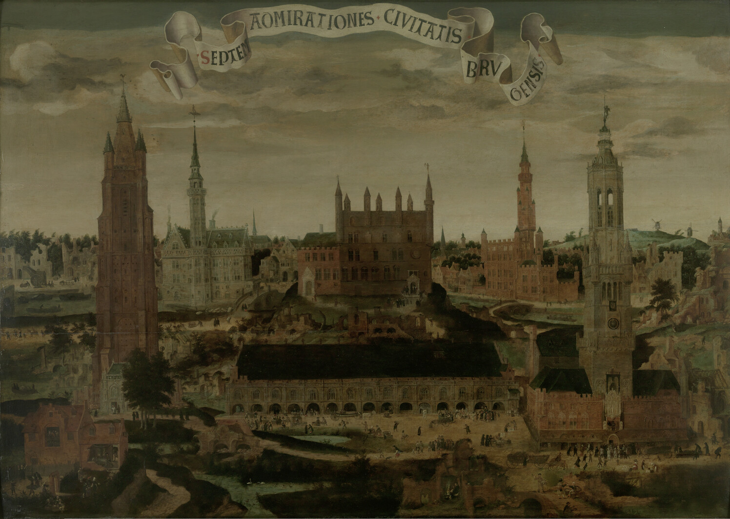
All the more reason to advertise the glory and beauty of Burgundian Bruges, and the metropolis it was then, with its symbolic buildings: the Belfry, the Halls, City Hall... They also grace another exquisite piece in this room: the painting featuring the 'Seven Wonders of Bruges', another PR tool. Take your time and enjoy the hundreds of details! And the other objects in this room, of course. If you look closely, you’ll see that some originate from buildings that can also be seen on the copper plates!
-
-
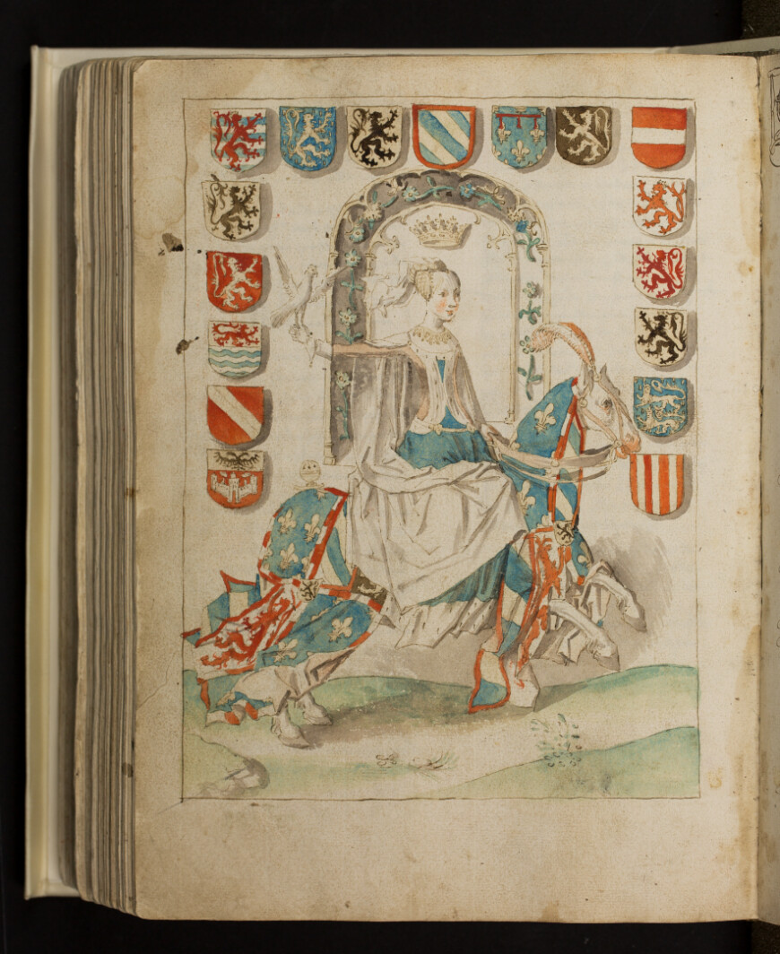
People who are rich and powerful like to show it. The counts of Flanders. A powerful, self-assured city such as Bruges. The young dynasty of the Dukes of Burgundy who enjoy residing in Bruges... All flaunt their wealth and power. They do this through buildings, their lifestyle and with great spectacles in the city: celebrations, tournaments and Joyous Entries.
These events linger in the collective memory. And the related stories are recorded for posterity, including in this wonderfully illustrated Excellente Cronike van Vlaanderen (Excellent Chronicle of Flanders). It tells the story of the history of Flanders 'from the earliest times to the end of the 15th century'. It recounts major political events, but also beached whales, terrible storms, city riots, and royal deaths and marriages. The author of the section starting in 1437 is the Bruges poet and rhetorician, Anthonis De Roovere. Bruges is the main character in his story.
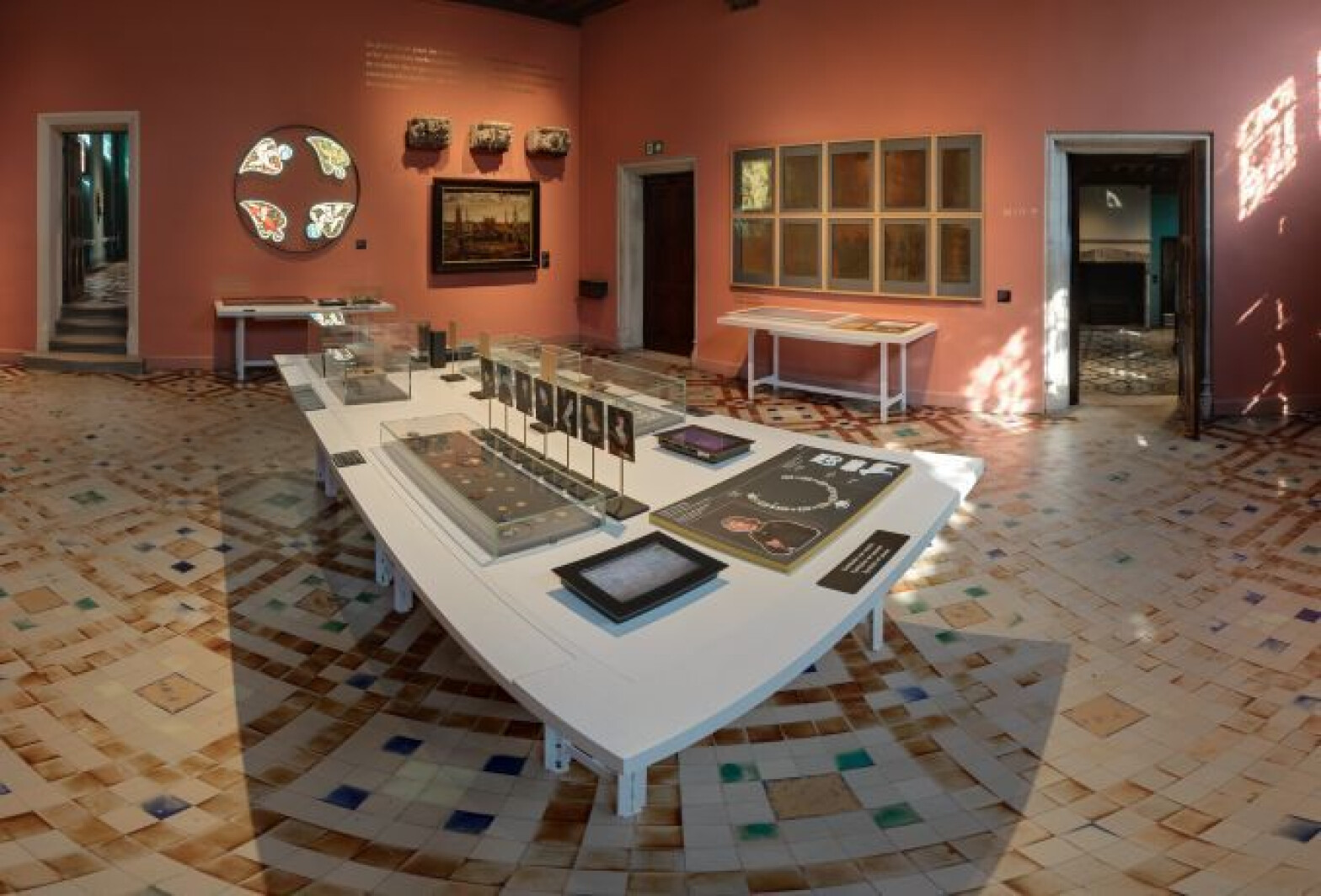
The Dukes of Burgundy set the example during this period. They attract powerful men to the hospitable court city of Bruges, who enjoy spending time in their company and imitating the rulers: with grand urban palaces like that of Louis de Gruuthuse. They are filled with art, expensive objects, and luxury, personalised floor tiles from Spain... Get to know this elite. Together with the rulers and the city council, they are responsible for the glory days of Bruges’ past. You can discover traces of their Spectacle State here.
-
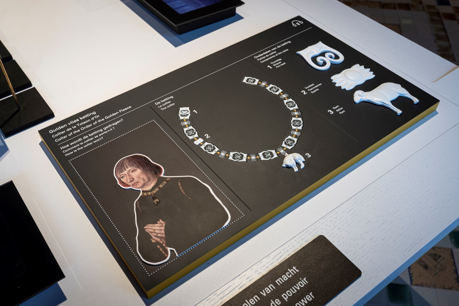
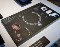
Louis de Gruuthuse and other members of the Order of the Golden Fleece distinguished themselves by wearing a collar. Here you can explore the elements and symbols that adorned the collar.